The Dan Trail Segments

The Dan Trail
Segments


The Dan Trail segments

Beaumont Mill Village Pathway

0.35 miles

Trailhead parking lot is located on East Boundary Drive

Beaumont Mill Village Pathway

Built by PAL, this trail connects to the Drayton Mills Marketplace and to Spartanburg’s downtown. The Pathway climbs from Lawson’s Fork Creek and the Drayton Mills Trails, making a few switchbacks up to Adams Park. From there, it will use the streets and sidewalks past the homes of the historic Beaumont Mill Village on its way to Pine Street and up Daniel Morgan Avenue into the downtown area.

Map

Butterfly Branch Greenway

0.4 miles

Behind Northside Harvest Park (near VCOM Carolinas)

Butterfly Branch Greenway

Owned by the City of Spartanburg, the Butterfly Branch Greenway is a visible sign of the Northside redevelopment project and connects to a Butterfly Creek that cultivates a fun, positive space for individuals of all ages to enjoy.

Map

Cottonwood Trail
Cottonwood Trail

1.8 miles

The trail can be accessed off of Beechwood Drive

Cottonwood Trail

Owned by Spartanburg Area Conservancy (SPACE), the Cottonwood Trail is a part of the Edwin M. Griffin Nature Preserve, a 116-acre urban preserve and trail system.

Map

Upper Drayton Mills Trail

1.2 miles

Trailhead starts off Doctors Park Dr at the Spartanburg Medical Center - Mary Black Campus

Upper Drayton Mills Trail

Owned by Pacolet Milliken and maintained by Spartanburg County Parks, the Upper Drayton Mills Trail connects into Drayton Mills Marketplace. Read more about the trail here.

Map

Lower Drayton Mills Trail

0.75 miles

Trailhead starts at the parking lot off Drayton Rd across from Drayton Mills Marketplace

Lower Drayton Mills Trail

Built by PAL and owned by Pacolet Milliken and maintained by Spartanburg County Parks, the Lower Drayton Mills Trail connects into Drayton Mills Marketplace. Read more about the trail here.

This trail is currently closed for construction; check back here for updates.

Map

Duncan Park (walking & biking)

Paved - 1.25 miles
Natural Surface - 4 miles

Trails main entrance is off Duncan Park Drive

Duncan Park

Duncan Park boasts paved and natural surface trails for walking, biking, and hiking. The 1.25 miles of paved trail is set to more than double with the completion of a perimeter trail around the lake.

See Existing Trail Map

See Proposed Perimeter Trail

Take The Perimeter Trail Survey!

Glendale Shoals
Glendale Shoals

1 mile

Located at the old Glendale Mill on Lawson's Fork Creek

Glendale Shoals

Owned by SPACE, the Glendale Shoals Preserve consists of 13 acres and features a scenic waterfall that cascades over a dam.

Map

Hub City Hopper
Hub City Hopper

From E Henry St. trailhead to Daniel Morgan Avenue

Hub City Hopper

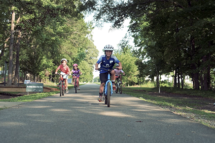
The first of its kind in South Carolina! A portion of the Hub City Hopper is a traditional asphalt trail for all users, and the portion on Converse Street splits users with cyclists in the curb-protected asphalt lane and pedestrians on an extra-wide concrete sidewalk. 

Map

Mary Black Foundation Rail Trail

1.9 miles

Located between South Pine Street and Union Street, the trail has access points at East Henry Street and at Country Club Road

Mary Black Foundation Rail Trail

Owned by the City of Spartanburg as a critical segment of both The Dan and The Palmetto Trail, the Mary Black Foundation Rail Trail includes Rail Tail Dog ParkHot Spot Skate Park, and The Rail Yard Community Park.

East Henry Street Access Point Map

Country Club Road Access Point Map

Mary H. Wright Greenway

1 mile

Trailhead starts at South Converse Park

Mary H. Wright Greenway

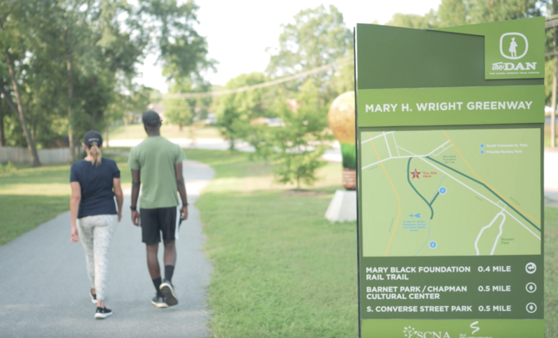
Owned by the City of Spartanburg, the Mary H. Wright Greenway includes a basketball court, two playgrounds, and a picnic shelter.

Map

River Birch Trail
River Birch Trail

2 miles

The trailhead starts off Sydnor Road behind the old Spartanburg High School tennis courts

River Birch Trail

Built by PAL and owned by the City of Spartanburg, the River Birch Trail is paved and is a great place for families with strollers, bikes or wheelchairs. It has recently been expanded from East Main Street along the Lawson's Fork Creek to the Drayton Mills Trails by way of Heywood and Beverly Roads.

Map

Three Creeks Trail
Three Creeks Trail

1.2 miles

Parallel to Fairforest Creek, this trail runs along Vanderbilt Road between W Main Street and Baltimore Street

Three Creeks Trail

Built by PAL and owned by Spartanburg County and the City of Spartanburg, Three Creeks Trail consists of on and off-road segments and is where the Holston Creek, Fairforest Creek, and Three Mile Creek merge at Vanderbilt Road.

Map

Wadsworth Trail
Wadsworth Trail

3.6 miles

501 Willis Road. The trail is three-pronged, with ending points on Willis Rd at Magnolia Park Estate, the intersection off Copperline Road through the school property to intersect with Oak Grove Road, and at the end of Caldwell Drive at Rock Springs.

Wadsworth Trail

Owned by Spartanburg County Parks, Wadsworth Trail connects eight neighborhoods and the Westside of Spartanburg. 

Map

Wildflower Way
Wildflower Way

The trailhead starts off Sydnor Road behind the old Spartanburg High School tennis courts

Wildflower Way

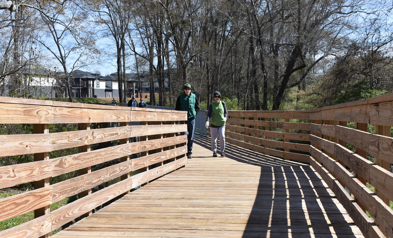
Wildflower Way is a paved, ADA accessible path within the Edward Griffin Preserve, owned by Spartanburg Area Conservancy. With limited access to this natural area for people with mobility limitations and strollers, this segment will open nature to our Spartanburg community.

The trail is being constructed in three phases. Phase 1A is complete.

More Info

Upcoming Events
National Trails Day

1/2

National Trails Day

June 6, 2026 | 9:00 AM - 11:00 AM

Celebrate National Trails Day with your friends at SPACE, PAL, Keep OneSpartanburg Beautiful, and the Local Hiker by giving back to the places you love! Join us for a volunteer stewardship morning where you can choose your own adventure - pick up litter along the trails, help pull tires and trash from Lawson’s Fork Creek, or team up to remove invasive plants from the landscape. All supplies will be provided, but please bring your own drinking water and work gloves if you have them. It’s a great way to care for our community, connect with neighbors, and make a visible impact on the Cottonwood Trail we all enjoy. Did we mention there's an afterparty?! After a hard day's work, go get cleaned up then meet us back at the Local Hiker! First drink is on the house for Trails Day Volunteers!

More Info

Do the DAN: Lightning Bug Walk & Talk

2/2

Do the DAN: Lightning Bug Walk & Talk

June 26, 2026 | 8:45 PM - 9:45 PM
meet up at the Cottonwood Trailhead located off of Woodburn Rd.

Join PAL and Professor Jonathan Storm of USC Upstate for a Lightning Bug Walk & Talk at Cottonwood Trail on June 26th! Explore the trail after dark, learn about lightning bugs and other nighttime wildlife, and experience one of summer's most magical natural displays. Click the title for more info and to RSVP !

More Info

Error Message